
Sorry, this one is sideways. Also note, even though the route says it takes a certain time, that doesn’t include the million stops. Today we actually overslept and got a late start (10:00 or so), and we’re just now finishing up at 10:00pm. Of course there’s plenty of light, so it doesn’t seem like a problem.
So many sights today! It really seems I should just do a continuous movie, cause the scenery is so constantly amazing,,, I can’t put my camera diwn for more than a couple of minutes!
So, here we go...again in a couple of installments.
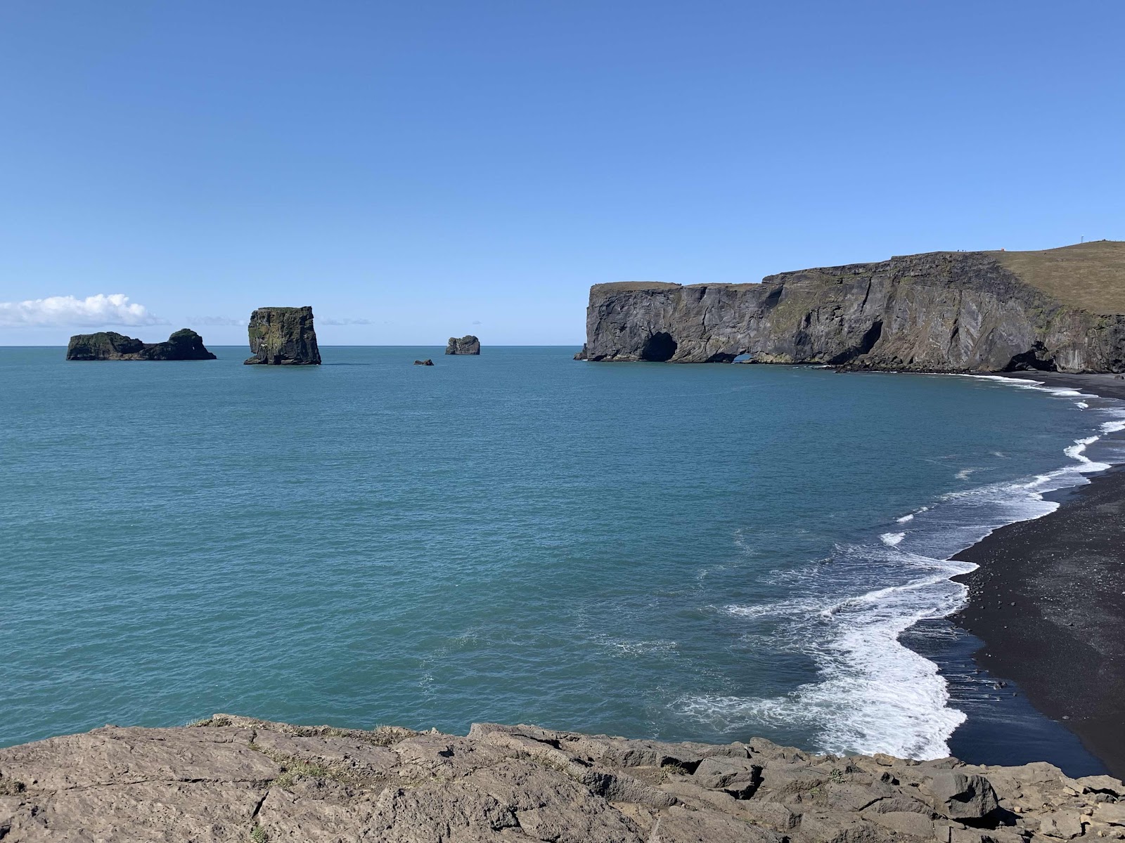
Right across from our hotel are these cool formations along a black sand beach, at the Dyrholaey Prometory. Thousands of nesting birds are noisy on the cliffs...but so far no puffins.

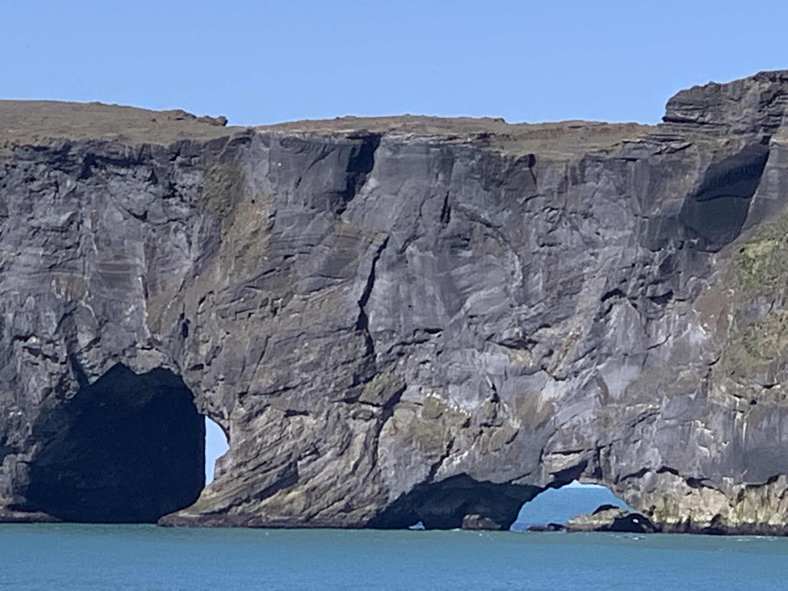
The bigger hole on the left is large enough to sail a ship through!
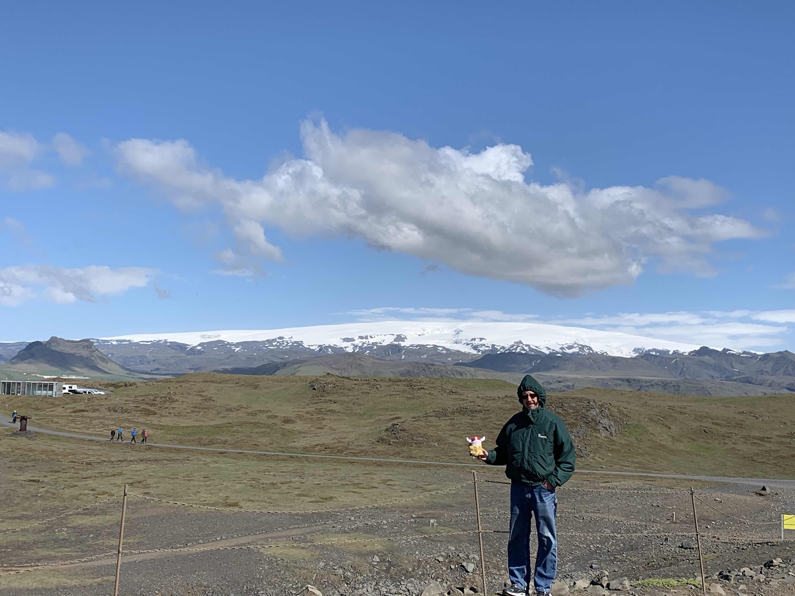
Here’s the mountain and glacier right behind our hotel, which you can see the roofline of on the left.
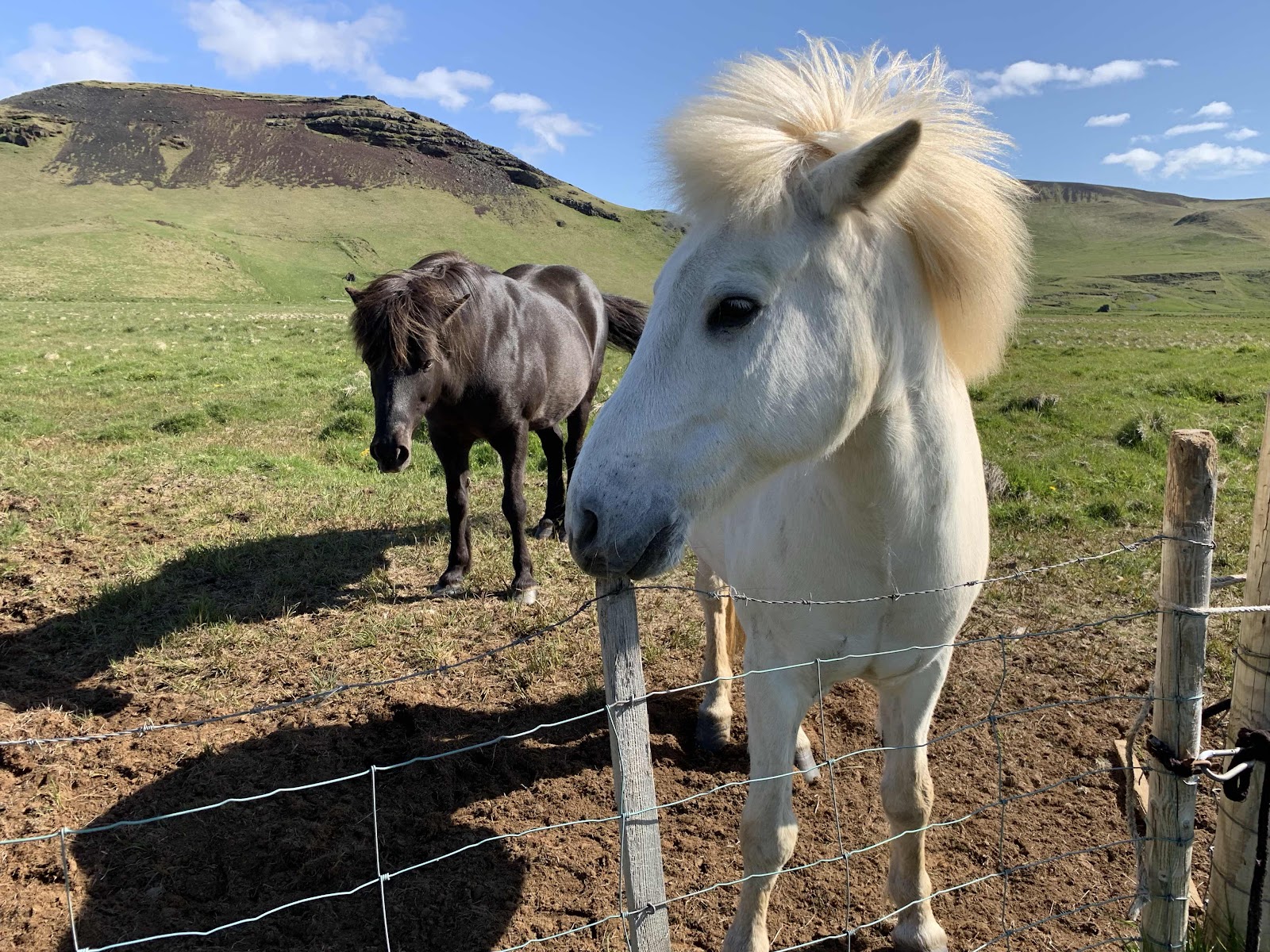
On the way from the beach, we met the nicest Icelandics. We’ve started saving apple cores for them!
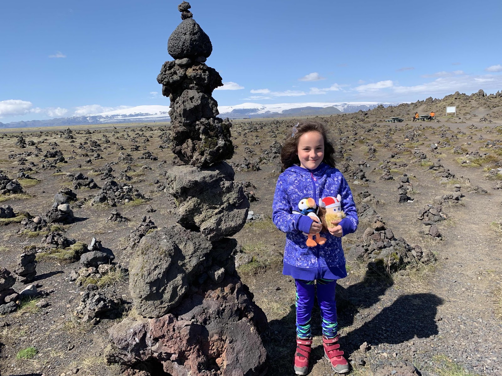
And finally, we press on, across the largest lava field in the world! We’ll actually be driving across it for much of today. It’s between two large glacier topped mountains, one named Krafla, the other is unpronounceable, but oftern abbreviated to H15...cause that’s how many letters come after the H! The entire area fed this lava field. So, on a stop between these two mountains, Ulf is playing, and a young girl comes almost running uo to him!

And finally, we press on, across the largest lava field in the world! We’ll actually be driving across it for much of today. It’s between two large glacier topped mountains, one named Krafla, the other is unpronounceable, but oftern abbreviated to H15...cause that’s how many letters come after the H! The entire area fed this lava field. So, on a stop between these two mountains, Ulf is playing, and a young girl comes almost running uo to him!
She too, has a special friend! His name is Puff. They of course become instant friends! Hoping that Puff whispered some secrets, we have now put Ulf in charge of finding some Puffins.
Our next stop/hike is back this beautiful canyon called...are you ready for this? Icelanders create long strun together words worse than Norwegians do! Here it is...Fjadrargljufur. Anyway, it’s beautiful. And, it’s so warm out that we’re pretty much not even wearing our jackets!
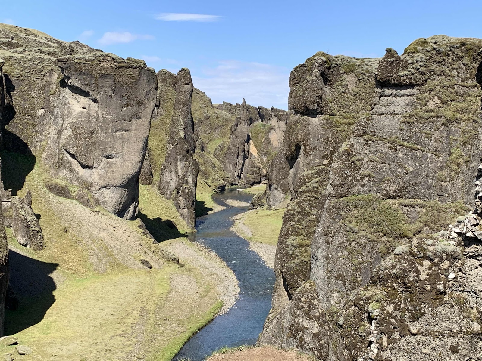
It was created 2 million years ago when an inland lake wore thru softer rock, then erosion continued it’s relentless job till the lake suddenly broke through the weaked area and created this ravine.

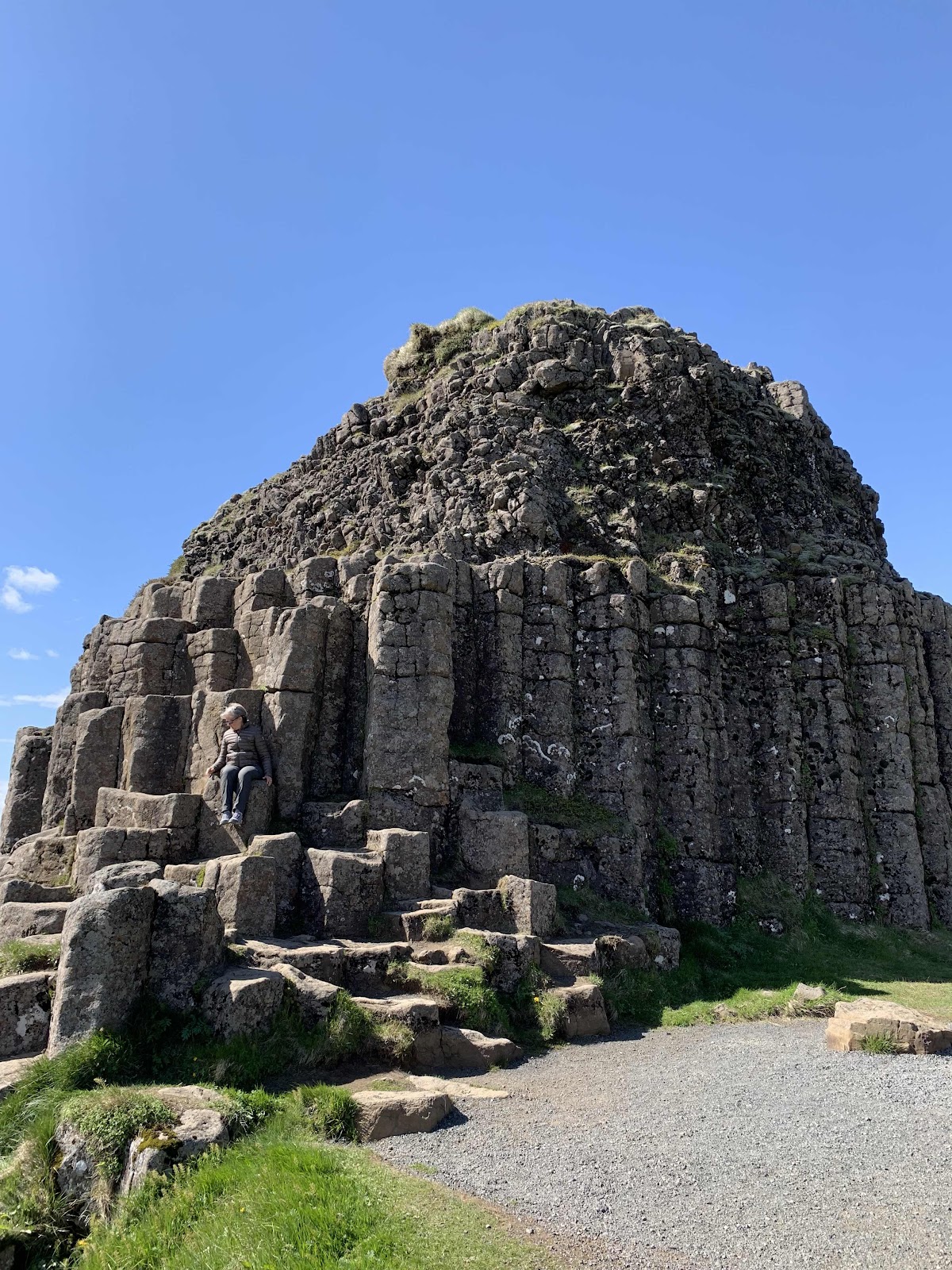
Lots of columbar jointing around here as lava colided with water and the sudden gas expulsion and cooling create these six sided ‘basalt crystals’.
No idea what formed this, It’s just out there in the lava field!

And now, we’re approaching H15. It absolutely massive! The highest point is 6950 feet, which at this latitude is more than high enough for it’s glacier to hold more water than Lake Victoria in Africa. It’s larger than the state of Delaware.


And with this, I’ll save what we found at the bottom for part two of day 3!
And now, we’re approaching H15. It absolutely massive! The highest point is 6950 feet, which at this latitude is more than high enough for it’s glacier to hold more water than Lake Victoria in Africa. It’s larger than the state of Delaware.
And with this, I’ll save what we found at the bottom for part two of day 3!
No comments:
Post a Comment